
The Hyper Maritime Subzone of the Coastal Western Hemlock Zone
As mentioned in Parts 1-4, the Coastal Western Hemlock Zone (CWH) is by far the most extensive vegetation zone on Vancouver Island and is divided into multiple subzones and variants. In this article, let’s get a sense of the hypermaritime subzone of CWH.
So, why the ‘hypermaritime’ moniker? As with a ‘hyperactive’ youngster, the use of ‘hyper’ implies extra or elevated. Indeed, this subzone of CWH is so close to the ocean that its climate is essentially that of the adjacent open ocean – there is virtually no ‘continental’ effect related to the greater heating and cooling of a land surface. Hence – mild temperatures, little frost or snow, lots of cloud cover and fog, high humidity and rain distributed throughout the year, including in summer.
Soils are invariably moist to wet (no drought period); in fact, poor drainage is the norm even on average sites of moderate hillslopes. When you walk through these forests, your boots sink into the soft, mucky forest floor usually accompanied by a squishing sound!
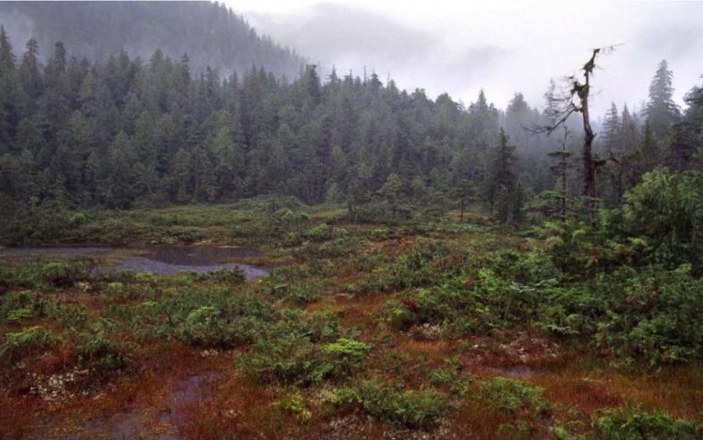
The most extensive, typical forest of average or zonal sites is dominated by cedars, mostly red cedar but often accompanied by yellow cedar (aka cypress), along with lesser components of western hemlock, shore pine and even mountain hemlock. So, you might ask, “why are the usual subalpine species – yellow cedar and mountain hemlock – growing right down to sea level”?
This is most likely a consequence of the prevailing wet soils – as any gardener will tell you, “Wet soils are cold soils” and the hypermaritime soil temperature regime at low elevations is similar to that of the subalpine. Consequently, these forests tend to have only moderate to low productivity because of the resulting poor growing conditions.
Perhaps surprisingly for a CWH subzone, western hemlock is not the dominant species that it is in the wet subzone. In most forests, including in the often-extensive swamp forest types (actually more woodland than forest), hemlock is subordinate to the cedars. When this type of forest was first surveyed and studied almost 50 years ago, I and a couple of other ecologists suggested this forest type should be recognized as a separate zone rather than as just another subzone of CWH (we lost that argument). Productive high forest dominated by western hemlock that is so common in the wet subzone (see Part 4) is limited in the hypermaritime to special sites that are particularly well drained so as to get rid of the excess moisture that the climate delivers. This includes the soils on steep slopes (colluvial slopes); soils derived from the sands and gravels of glacial meltwater deposits, fluvial and raised beach deposits, or soils over particularly permeable bedrock like limestone and even the ash and cinders of recently active volcanic cinder cones (a rare situation [Kitasoo Hill] on Swindle Island).

Because of the shorter tree heights and relatively open crowns of the cedars on all but the rather exceptional hemlock dominated sites, neither windfall nor wildfire are important as agents of disturbance and stand renewal. Consequently, most hypermaritime forest are much older than what elsewhere is considered ‘old-growth’ (i.e. >250 years). Indeed, these are truly ancient forests that have been around, and little changed for more than 1,000 years or perhaps even for several millennia.
The species mix on average or wetter sites of moderate to subdued topography is more diverse than just about anywhere else in the CWH. The swampy woodlands are particularly diverse. This arises because of micro-site variability – the intricate mix of somewhat better drained organic hummocks interspersed with intervening wetter depressions supporting the different species that such diverse growing conditions favor. On Vancouver Island, the cedar-dominated forests typically have a dense, almost impenetrable cover of salal, which strongly contrasts with the hypermaritime of the central and north mainland coast. Why salal cover drops so dramatically to the north remains a puzzle – is it a climatic effect, or perhaps the influence of deer (browsing) because of the much higher deer populations (although smaller in stature) on the mainland?
Truly rich, more fertile sites are few and far between in the hypermaritime likely because it is hard to overcome/compensate for the prevailing cool, wet soils. The most notable exception is the fertile, highly productive, tall Sitka spruce forest of alluvial sites along larger rivers that can be seen flanking the VI Trail when you cross the Shushartie, Nahwitti and Stranby Rivers. These alluvial sites will have the lush sword fern and salmonberry seen elsewhere in the CWH, along with variable lesser cover of foamflowers, other ferns and members of the lily family. Sitka spruce forest is also seen on the well-drained, sandy soils of former beach deposits immediately behind the beautiful present-day beaches along the North Coast Trail section. These tend to have a moss-dominated ground cover with fewer shrubs and herbs.
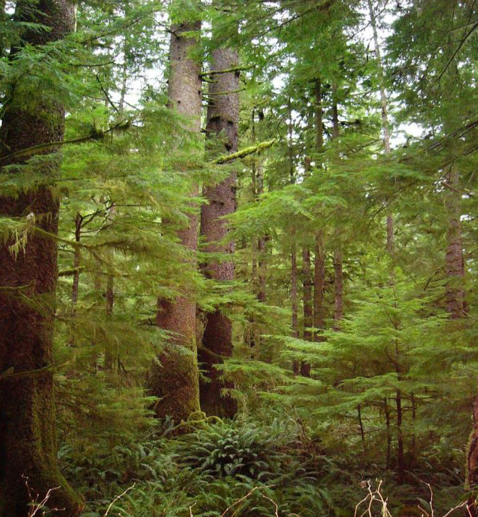
A final, I think intriguing question: Did the peatlands of Ireland and the moors of Scotland have forests something like this before the advent of Man and his grazing animals?
T. Lewis – August 2022