
Section 7: Port McNeill to Cape Scott
Length: 134 km
Elevation: 0 to 300 metres
Total Ascent/descent: 1,990 / 2,060 metres
Proportion: 56% trail, 18% road and 26% water
Status: To Port Hardy, the route lies within the traditional territory of the Kwakiutl First Nation and establishing the trail awaits further consultation with the Nation. The North Coast Trail is within Cape Scott Provincial Park. The alternate road route from Port Hardy to Shushartie is along logging roads within managed forest.
Trail standard: 18 km of the 43 km to Port Hardy is either beach/rock-shelf or rough (rooty) single-track trail with the remainder over inactive logging roads. The 35-km water section involves paying for a water-taxi. The North Coast Trail section is a muddy, often steep single-track trail (the excessive mud resulting from the highly organic soils of the very wet, hypermaritime climate), interrupted by kilometers of sand and shingle beach.
Difficulty: Between Port McNeill and Port Hardy, terrain is almost flat to gently undulating and sections of trail are rough and rooty. The North Coast Trail is challenging, hence suitable only for experienced hikers. Inland sections are extremely muddy and difficult to traverse with sections of boardwalk that can be very slippery when wet and with sections requiring hikers to climb over or along fallen trees, as well as to cross through deep mud and use fixed ropes to traverse steep sections.
Character: Almost entirely coastal unless the alternate road route through hilly upland is followed. The coastal route includes a mix of beaches and rock-shelves (lower tides) and trails somewhat inland, largely through or adjacent to native old-growth and mature forests. Managed forest with an extensive logging history and a wide range of forest ages is seen for several kms north of Port McNeill and along the alternate road route to Shushartie Bay.
Facilities: The campground and cabins of the Cluxewe Resort are situated at the mouth of the Cluxewe River. Port Hardy has a full range of services, including the Backpackers’ Hostel. There are seven designated campgrounds along the North Coast Trail. Water sources are surprisingly limited in spite of the very wet north-Island climate. Creeks exiting onto the shoreline are typically not at all obvious and often hard to find.
Short Description: From Port McNeill to Port Hardy is a mix of single-track trail and old road near the coastline, much of which can be hiked on the beach or rock-shelf at lower tides. From Port Hardy to Shushartie Bay, hikers choose either water taxi or logging roads. Shushartie Bay to Cape Scott is via the rugged North Coast Trail (Cape Scott Prov. Park) through or adjacent to very wet hypermaritime forest, woodlands and wetlands bogs, with several spectacular beach sections. There are cable car crossings of the Nahwitti and Stranby Rivers, both flanked by impressive alluvial Sitka spruce forests. Towards Cape Scott and its lighthouse can be seen remnants of the works of early Scandinavian settlers. Hikers return via the Cape Scott Trail to road access at San Josef River near Holberg.
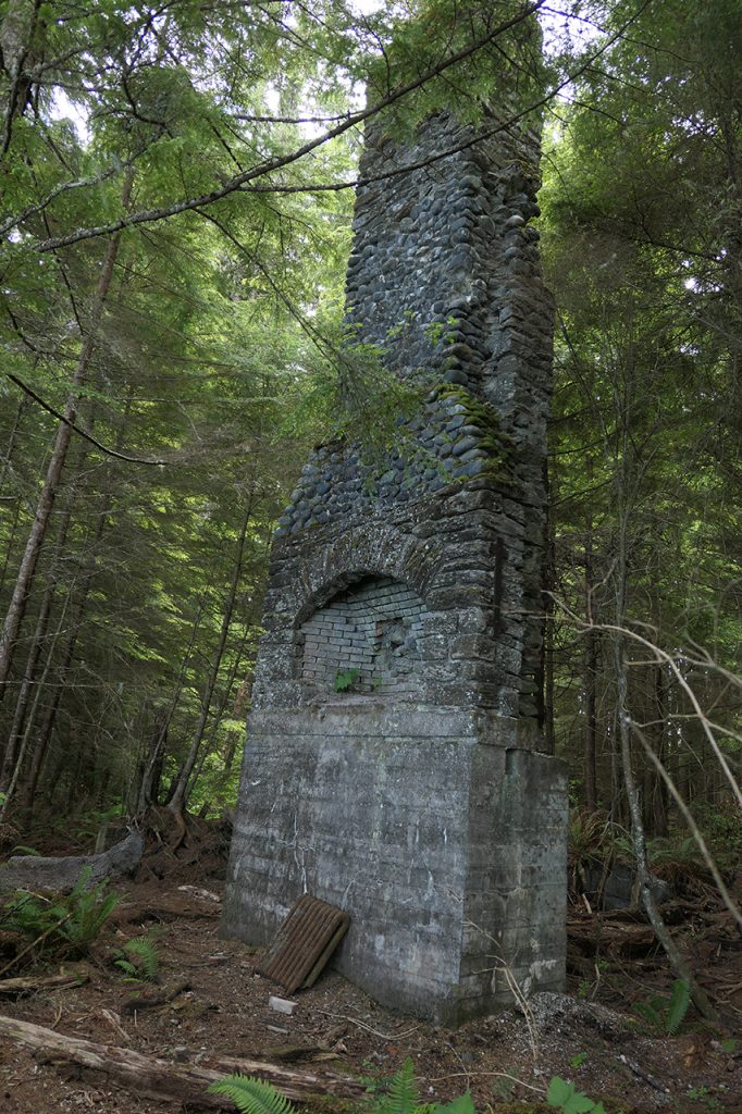
Highlights & Lowlights: Cluxewe estuary and saltmarshes, Suquash coal mine ruins, shoreline hiking, beautiful NCT sand beaches, Guise Bay beach and dunes, Cape Scott settlement remains and lighthouse. Hiking the road route to Shushartie can be dusty and tiring. Although rather expensive, the water taxi option provides a good sense of the beautiful coastline and near-shore waters of Vancouver Island.


