
Section 3: Port Alberni to Cumberland
Length: 83 km
Elevation: 90 to 1,540 metres
Total Ascent/descent: 5,290 / 5,220 metres
Proportion: 87% trail and 13% road
Status: Not officially open with several land use agreements over private forest lands needing to be finalized.
Trail standard: Well defined single-track with forest floor tread in forested sections. Somewhat obscure to poorly-defined in semi-open subalpine heaths requiring route finding that considerably slows rate of progress.
Difficulty: After an easy section of old rail grade, the route starts with an arduous climb (1100 m in 10 km), then repeated up and down over hilly ridges and plateaus with some short and very steep pitches. Section ends with easy mostly downhill trail into Cumberland.
Physically demanding – several hikers have not been able to complete this section.
Character:
- Lower elevation sections involve steep, valley slopes at the south end and moderate uplands at the north end through managed forests.
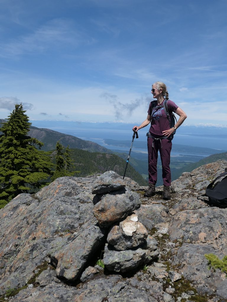
- The central higher-elevation section is mountainous with a wilderness character, through a mix of subalpine forest and subalpine to alpine parkland and heath. The crest topography is complex which increases both physical effort and navigation difficulty.
Facilities: No formal campsites. Hikers typically bivouac near water sources such as Tsable Lake. After the early dry climb, water is readily available from numerous lakes and tarns in the subalpine and at several lakes and streams on the descent into Cumberland.
Short Description: From the city trails around Port Alberni, the VIT first follows 7 km of the Log Train Trail and a section of logging road before making a steep climb up to the crest of the Beaufort Range between Mt. Irwin and Mt. Hal. From that point, the route is along the Beaufort crest via mountains Hal, Joan, Squarehead, Apps, Cameron, Henry Spencer, and Stubbs to Tsable Mountain through subalpine forest and beautiful semi open mountain hemlock parkland. VIT then descends the NW ridge of Mt. Tsable to cross over the upper Katlum valley and back up to follow a narrow ridge above Silver Snag and Twin Lakes valleys before descending to and around Tsable Lake. Single track trails through managed private forest lands continue down to a crossing of the upper Trent River. From this point mountain bike/hiking trails lead to the former coal mining village of Cumberland.
Highlights & Lowlights: Subalpine parkland vegetation and heather meadows with numerous lakes and tarns. Expansive views west into Alberni Valley and east to Georgia Straight, Denman, Hornby and Texada Islands and the Coast Mountains; Beaufort and Tsable Lakes, Trent River potholes and historic Cumberland. The apparently straightforward Beaufort crest is a challenging up and down hike across many ridges, minor summits and open rock, after the long, steep initial climb up to the crest.


